4 May 2017
Today was supposed to be the warmest, sunniest day of our stay in Vancouver, not that I always believe the weather forecast you understand. There was sun outside our hotel window when we got up this morning though and, when we walked down West Broadway in search of breakfast, it was warm even though it was still before eight. Over coffee, croissants and parfaits we both agreed it was the perfect day for a walk on the beach.
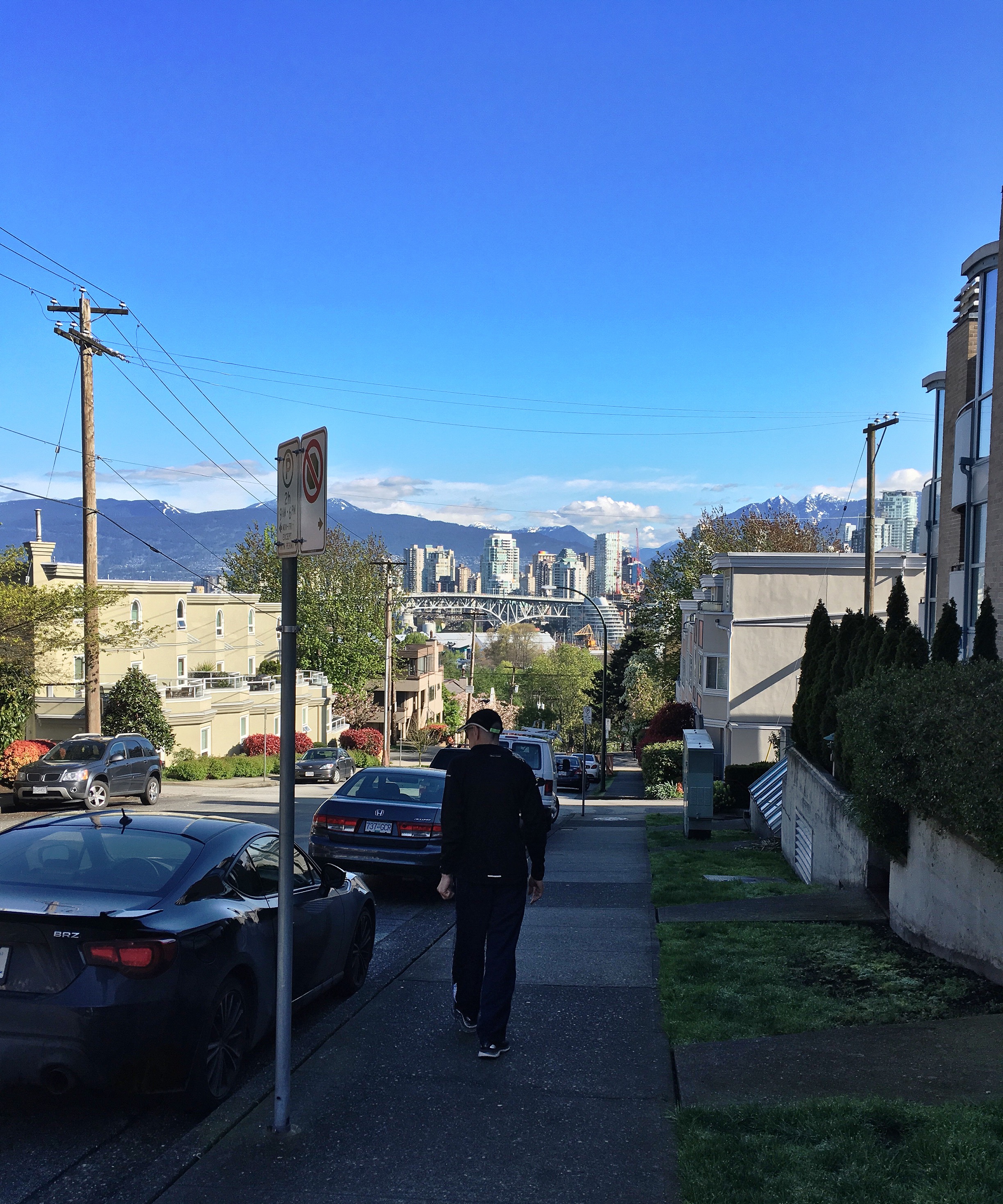
With blue skies and warm sunshine our trip down to Granville Island was a great deal more pleasant than yesterday’s. After all the rain I was glad to see blossom still on the trees, even if a lot was scattered on the paths and roads. The sight of those fluttering pink petals sparkling with left over rain, made me smile. Unlike yesterday we dawdled along, enjoying the warmth on our skin and remarking how clean and fresh the air was despite being in the largest city in British Columbia.


On the narrow strip of land dividing South Vancouver from the island that’s really a peninsular we stopped to look at the mass of small boats reflected in the mirror smooth water. Everything looks so much better when the rain stops and the sun comes out.


Today we were better prepared for the aquabus too. A little research told us which one to take for the beach and that a return ticket was our best option. These little ferries have been operating in False Creek since 1979 and there are currently eleven little boats running year round used by locals and tourists like us. Today we were riding on Spirit of False Creek. It was a longer journey and far more pleasant with the sun above and the water below rather than falling from the sky.


As we skimmed across the wonderfully clear water we had a great view of the Public Market and the Granville Street Bridge. The rather utilitarian metal structure is actually the third incarnation of the bridge carrying Highway 99 across the creek. The first was built in 1889 out of wood and had a swing span near the north end. The second bridge, completed in 1909, was made from steel and also had a swing span. The current bridge was built in 1954. It cost $16.5 million and the first car across was driven by the same woman who drove the first car across the original bridge. Both her journeys were made in a brand new Cadillac.

Before long we were passing under the Burrard Bridge built in the early 1930’s in Art Deco style by architect George Lister Thornton Sharp and engineer John R. Grant. The beauty of this bridge is the concrete towers with interesting balcony like openings overlooking the water. The Aquatic Centre Dock was close to the bridge and we were soon walking up the ramp towards Sunset Beach.


To our right, on the east side of the dock, is a small shingle beach reserved for dogs and, on the foreshore behind a row of trees, is the aquatic centre that gives the dock its name. If we’d known about it yesterday we might have visited and saved ourselves getting wet in the rain and got wet by swimming in the pool instead. Although it was getting close to ten o’clock, the beach was surprisingly empty for such a beautiful day. A few people were walking along Beach Avenue, the walkway that runs all along the shore, and a bicycle was leaning against a bin, possibly owned by the lone woman on the sand walking her dog.

Across the creek we could see tents in Vanier Park. Commando thought there might be a fair there. Later Jen told us this was Bard on the Beach, Western Canada’s largest professional Shakespeare festival, running since 1990 from early June until the end of September. On our side of the creek the only occupant of the beach, besides the lady and her dog, was a heron standing in the shallows. We watched him watching the water, thinking we might see him dive down to catch a fish but he stood there perfectly still and our patience ran out before his did.


Giving up on the heron we headed along the sand towards English Bay Beach. Jen had told us this was a lovely beach and its name alone made us want to see it. The woman and her dog had disappeared by this time and we had the beach to ourselves. Ahead large logs were scattered on the sand like the remnants of a giant game of jack straws, presumably to act as windbreaks or seats. In the far distance we could see some kind of U shaped arc. Curious, we headed towards it.

When we got closer we discovered the arc was made of bands of rusting steel their edges sticking up at different heights. Later we’d find out this was a sculpture by French artist Bernar Venet. It consists of thirteen arcs, is part of a series of Arc sculptures and has been on the beach since 2007. I loved the way the mountains and sea were framed through the rusting metal curves. Of course I stopped for photographs.


A little further on we stopped to rest on the large piles of stones on the edge of the shore. Around the curve of the Sunset Beach, behind the skyscrapers we could see the trees of Stanley Park and the mountains rising up towards a thin layer of cloud. The calm water of English Bay was dotted with ships, some small yachts, others large tankers like the ones we see going in and out of port at home. None of the tankers seemed to be moving.
“I think the port is around the other side of Stanley Park,” Commando said. “Maybe they’re waiting in the bay until they can get in. They don’t have two high tides a day like us after all .”


The Port of Vancouver may not have two high tides each day but it is the largest port in Canada, the Pacific Northwest, and the West Coast of North America handling 76.5 million metric tons of cargo every year. While Commando was wondering about the tankers I was wondering about the galleon I’d spotted, looking a little incongruous amongst all the modern ships. It reminded me of an empty beach in Sousse many years ago before the same beach became famous for something altogether more horrific. The galleon I’d watched each morning there was much like this one but it was the only ship in sight and seeing it always made me feel I’d been sucked into a time warp.
“Perhaps it’s some kind of themed tour ship,” Commando suggested. “Like the ones we saw in Tunisia and Paphos.”

Thinking about Sousse made me restless so we left the rocks and carried on along the beach. By this time it was getting rather warm. Commando said he wished he’d worn his shorts. The shells on the shore here were all dark purple. I stopped to pick a couple up. Ahead of me, Commando pointed out a huge crab claw. We both wondered where it came from and what happened to the rest of the crab?


Soon we came to another sculpture on the grass of the foreshore, behind the path. Two metal hoops sticking out of the grass angled away from each other were topped with pointed glass structures.
“It looks like two engagement rings,” Commando said.
Until then I’d been thinking lanterns but, as soon as he said it, I could see what he meant. Later I discovered the sculpture, by Dennis Oppenheim, is called Engagement so Commando was right about the rings. Like the arc we saw apearlier this is one of a series. It was installed in 2005 and there are others at the Nevada Museum of Art in Reno, San Diego, California, Ruoholahti, Finland, and Leoben, Austria.

As we came towards the edge of the Sunset Beach bay we could see out towards the open sea. We thought the water we were looking at was the Pacific Ocean. In fact, it was the Salish Sea, an intricate network of inland waterways partially separated from the open Pacific by Vancouver Island and the Olympic Peninsula, and shielded from Pacific Ocean storms.

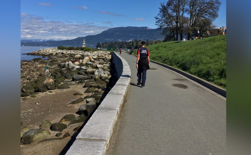
When rocks blocked our forward progress we left the beach and carried on along the path. Ahead we could see an inukshuk and, in an echo of this, the rocks were dotted with little cairns. They reminded me of the cairn I’d made in Cyprus and I wondered if it was still there?


Both cairns and inukshuks serve the same purpose. They act as markers or points of reference for travellers, showing the way, pointing out fishing places, hunting grounds and representing northern hospitality and welcome. They are used by the Inuit, Iñupiat, Kalaallit, Yupik, and other peoples of the Arctic region of North America and are widespread in Canada. In some places an inukshuk may be simply a large, upright stone but the cross shaped, human like version is seen most often in Canada. The name inukshuk means in the likeness of a human in the Inuit language.

This partucular inukshuk was built of grey granite by Alvin Kanak of Rankin Inlet and commissioned by the Government of the Northwest Territories for its Pavilion at EXPO 86. Later it was given to the City of Vancouver and was moved to this site in 1987. When Vancouver hosted the Winter Olympics in 2010 an inukshuk based on this one was used as the basis of the logo designed by Vancouver artist Elena Rivera MacGregor. This was controversial amongst the the First Nations people of British Columbia as they did not make inukshuk but the meaning of welcome and hospitality was well meant.


The inukshuk marked the beginning of English Bay Beach, the most popular sunbathing and swimming beach in downtown Vancouver. The beach and the bay it overlooks were named English to commemorate the British Captain George Vancouver. Vancouver was an English naval officer who, in the 1790’s, explored and charted North America’s northwestern Pacific Coast. Vancouver Island is named after him.
In the late nineteenth and early twentieth centuries English Bay Beach was home to Vancouver’s first official lifeguard, Joe Fortes, known locally as Old Black Joe or English Bay Joe. He had a cabin on the shore and taught hundreds of early residents how to swim. When he died, in 1922, his funeral procession was record breaking and he is buried in Mountain View Cemetery under a flat stone marked simply Joe. This morning the beach was strangely deserted apart from us and a stuffed toy shark that seemed to have been abandoned.


As we came towards the edge of the trees a man in a kind of park warden outfit approached us and asked if we needed any help. We told him we were just wandering.
“Well, if you go this way,” he pointed to our right, “you’ll find the Lost Lagoon, a lake created when they built the causeway. If you follow the sea wall you’ll end up going right round the outside of the park.”
We thanked him for his help and said we’d carry on along the sea wall for a while at least.

We walked on towards Second Beach on the edge of Stanley Park. To our right the grassy foreshore and tall buildings gave way to rocky cliffs with trees perched precariously on narrow ledges or growing from crevices that seemed far too small to accommodate their roots. The beach was partly shaded by the trees and the edges of the rocky shore were green with algae.


We passed a swimming pool, closed and in the process of being cleaned. A little further on we found a seat and stopped for a while looking back at the shore we’d walked along, the downtown skyscrapers we’d passed and the bridge we’d sailed under from Granville Island. Now it was time to decide whether to keep following the path along the sea wall or to try to find a way up into the shade of the park.


Please see my copyright information before you copy or use any of the above words or pictures.
What a lot of interesting things you saw on your walk, thanks for sharing.
Vancouver has so much to offer and we only really scratched the surface.
I’m glad you’re enjoying such a beautiful place. Now you’ve given me ANOTHER idea for a travel destination!
It really is a fantastic place. We fell in love with canada on our last visit to Toronto. Vancouver didn’t disappoint at all.
That is such a beautiful place and it looks like you picked the perfect time to go.
It really is stunning, just wait until you see Stanley Park though! With all the blossom out along the streets this really was the best time to visit.